Ryzyliant EDGE Mapping™ seamlessly integrates with your existing CAD and 9-1-1 systems, transforming emergency response through enhanced geospatial data and situational awareness. This translates to dramatically improved location accuracy and faster response times, saving precious seconds in critical situations.
EDGE Mapping goes beyond just displaying location data. It provides a comprehensive suite of tools that empower you to build, maintain, and customize your local mapping data exactly how you need it. The user-friendly interface ensures a smooth learning curve for your dispatchers.
Whether you utilize Ryzyliant’s EDGE CAD solution or a third-party CAD or NG9-1-1 system, EDGE Mapping seamlessly integrates. It also adheres to NENA’s EIDO standard interface for maximum compatibility.
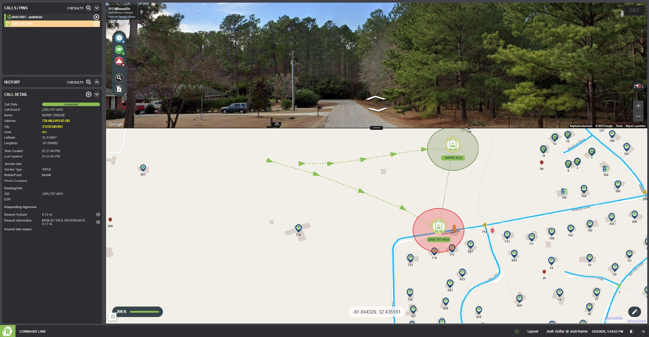
With EDGE Mapping™, the origin of every incoming 9-1-1 call is automatically pinpointed on the map. This real-time data allows dispatchers to intuitively review calls and access historical information for any address. Additionally, the system logs all activities, ensuring a complete record of events.
Dispatchers and call takers benefit from having accurate and readily available data at their fingertips. EDGE Mapping allows for on-demand printing, streamlining processes and facilitating clear communication with first responders.